Cloonmoyle Monuments
Pauline Connolly

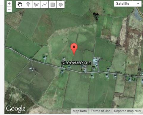
Monuments in Cloonmoyle
There are 3 ringforts and a souterrain in Clooomoyle.
The first ringfort is situated on a rise in undulating grassland. It is a subcircular rath which is in relatively good condition, defined by a bank and external fosse.[1]
The second ringfort is located on a rise in undulating grassland. It is a poorly preserved conjoined ringfort. A souterrain lies within the interior.[2]
The third ringfort is situated on the south west slopes of a low hill in rolling grassland overlooks boggy terrain to the south west. It is poorly preserved defined by two banks and an intervening fosse. A road cuts through it and is bisected by a field wall.[3]
The souterrain is which consists of 2 chambers is located within the south enclosure of a conjoined ringfort.[4]
[1] GA016-041—-(Archaeological Survey of Ireland, Record Details). http://www.archaeology.ie compiled by Olive Alcock, Kathy de hÓra and Paul Gosling. Uploaded 05th August 2010 (11th March 2015)
[2] GA016-041—-(Archaeological Survey of Ireland, Record Details). http://www.archaeology.ie compiled by Olive Alcock, Kathy de hÓra and Paul Gosling. Uploaded 05th August 2010 (11th March 2015)
[3] GA016-043—-(Archaeological Survey of Ireland, Record Details). http://www.archaeology.ie compiled by Olive Alcock, Kathy de hÓra and Paul Gosling. Uploaded 05th August 2010 (11th March 2015)
[4] GA016-042001—-(Archaeological Survey of Ireland, Record Details). http://www.archaeology.ie compiled by Olive Alcock, Kathy de hÓra and Paul Gosling. Uploaded 05th August 2010 (11th March 2015)


No Comments
Add a comment about this page